LINKDAPA – LINKing multi-source Data for Adoption of Precision Agriculture – is a project funded by EIT Food, the Europe’s leading food innovation initiative.
LINKDAPA’s goal is to elaborate and make usable big data collected on field to maximize winter cereals yield. The project is based on the use of innovative tools and technologies for in-field data collection, which are spreading among farmers.
This determines that a big quantity of data related to yield, vegetation development, soil characteristics and field observations are available to the farmer. These data have a big information potential, but they cannot give the best support to farmers and technicians unless not correctly elaborated.
This is the reason LINKDAPA project aims to develop algorithms and tools for exploiting the informative potentials of data, in order to give to farmers and technicians practical information for crop management.
Watch the official video project here > LINKDAPA project.
The project
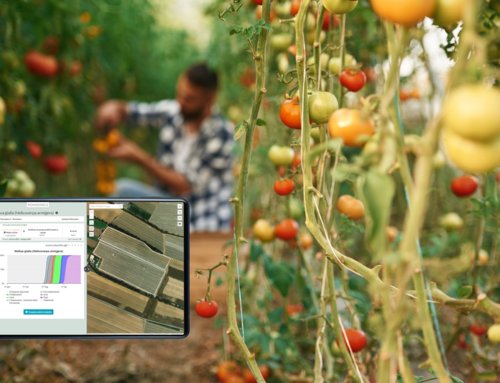
The project will develop an automatic system to be used by farmers and technicians within the end of 2021. The system will be able to ingest and elaborate big data from field, and to give useful information for supporting decisions related to winter cereals cultivation.
The tool will integrate high levels of technology, while being very easy to use. The features developed by the project will be dedicated to
- early yield forecast
- protein map forecast
- yield map ingestion
- fertilizer prescription maps
keeping an eye on the economic convenience of the agricultural practices.
The partners
Linkdapa consortium is composed by 4 partners: the University of Reading, located in United Kingdom, John Deere and the university of Hoheneim, both located in Germany, and Agricolus, located in Italy.
The University of Reading coordinates the project. Researchers perform data analysis and management to develop forecast models. Moreover, they conduct socio-economic studies for product co-creation.
The University of Hoheneim performs data supply and analysis. Researchers work with John Deere to provide multi-spectral imagery for fields in Germany and UK.
John Deere provides access to lead farmers in Germany and UK. It also represents a technical reference point for yield maps collection. Agricolus provides expertise in data fusion and creation of user interfaces. Moreover, it supplies satellite images and assistance for their interpretation.
Agricolus and John Deere are also responsible for commercialization of results by developing existing software platform.
The project is developed involving more than 10 farmers in Italy, Germany and UK for the co-creation of the tools. Agricultural experimentations are carried on more than 15 fields located in the three countries.