Vegetation indices are a Smart Farming key tool: how to use and “read” them for efficient crop management?
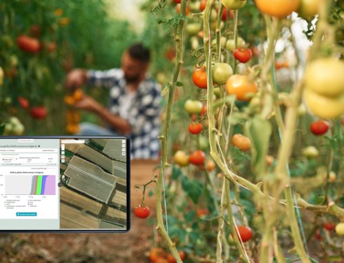
In the farm the use of satellite data and their correct interpretation reduce field interventions and make crop scouting activity sustainable from an economic point of view.
There are various types of indices that describe different aspects of vegetation.
Vigour indices, such as NDVI, are influenced both by plant development in terms of green biomass and by greeness, that is the green colour of the plant. An area of the field where low NDVI is detected may be affected by chlorosis, or may present emergency problems (in the case of herbaceous crops) or poor vegetative development.
Chlorosis indices (TCARI/OSAVI) are influenced only by the presence of chlorophyll and do not take into account the development of the plant in terms of vegetation: they are therefore useful to identify the presence of chlorine areas.
Water stress indices (NDMI and NMDI) are influenced by the water stress of the plant or by the water amount of the bare soil.
Three steps to read satellite vegetation indices
- Observe vigour indices: the synthetic indication they give us is sufficient to identify areas where vegetative stress is concentrated.
- Compare the vigour index with a chlorophyll index. If in areas with vegetative stress the chlorophyll index indicates absence of chlorosis, the low vigour will be due to a problem of vegetation development, caused for example by a low emergency or a delay in vegetative development. If, on the other hand, the areas with low vigour correspond to chlorine areas, there is a strong and evident damage to the vegetation, which can be caused by insects or diseases due to nutrient deficiency or water stagnation, or by atmospheric phenomena such as strong hailstorms. In case of low or no vegetative stress identified by the vigour index, the chlorophyll index may be useful to identify chlorine zones but with good vegetative development.
- Compare the vigour index with a water stress index. If the water stress index shows areas with water scarcity and vigour is high, this is a recent stress that has not affected plant development; if vigour is low, there are poorly developed plants with water stress. In any case, when the vigour of the plants is low, whatever the cause, the water stress indices will never reach very high values.
Vegetation indices interpretation and crop scouting
The above reasoning is useful to define the areas where there are more or less evident symptoms of vegetation suffering. In addition, they allow to identify causes. This information represents a great help for the optimization of crop scouting interventions, as it allows to plan them by carrying out vegetation surveys mainly where the satellite indicates suffering vegetation.
The advantages? More precise and targeted interventions and reduction of the number of observations required. Furthermore the indices reduce the risk of not identifying problem areas, because during a survey it can happen that only a part of the field is observed, while the satellite data offers a “privileged” view, from above, which allows to detect pixel by pixel the status of the crop.
Satellite indices do not have a proven effectiveness in identifying pathologies in the early stages of development (that is, when the treatment can be more useful), so that satellite data are powerful if associated with the interpretation of the results of forecast models.
In fact, the absence of areas with vegetative stress identified by the satellite, combined with the absence of infestation risks identified by the model, may make field monitoring superfluous, while the indication of risk of specific pathogens by the forecast model will lead to pay more attention to phytosanitary monitoring.
Find out Agricolus Observa for crops monitoring from satellite or