The United States Department of Agriculture (USDA), in the World Agricultural Supply and Demand Estimates of 10 March 2020, forecasts a reduction in maize stocks in 2020. In addition, research in the agricultural sector is focusing in the study of productive hybrids that are resistant to the main adversities and climate instability.
Obviously we do not know how the world situation could change in the coming months, also because of the health emergency we are facing, but at present we can assume that growing maize in this season is a good decision.
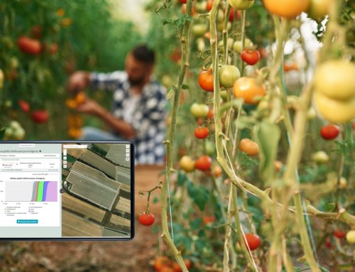
MaysDSS
Remote crop monitoring is becoming a valuable resource for maize growers. For this reason Agricolus provides farmers with specific tools in MaysDSS solution: forecast models, vegetation indices, and prescription maps.
Forecast models: defense and irrigation
Forecast models support the farmer in defining the best defense strategy and optimising irrigation, as well as forecasting the phenological development of the plant.
The models for maize defense are able to predict the development of European corn borer, Helicoverpa armigera, and Western corn rootworm: insects that feed on the vegetative part of the plant causing serious losses. In this way the farmer knows the exact days when the insects are at dangerous stages of development for the crop, or more sensitive to treatments.
The forecast model for irrigation allows to quantify daily water stress of maize and the water needed to fill it by calculating a complete water balance. In this way it will be easy for the farmer to optimize irrigation interventions, providing the right amount of water without waste.

Forecast models for maize in Agricolus platform
Vegetation indices
The use of satellite data and their correct interpretation reduce the interventions in the field as much as possible and make a structured crop scouting activity economically sustainable.
The “top-down view” makes it possible to identify any problems that are developing in the field (a rust principle for example), and act promptly to solve them.
There are several types of indices that describe different aspects of vegetation:
- Vigour indices, such as NDVI, are influenced both by plant development, in terms of green biomass, and by greenness. Among the vigour indices we can find LAI: it numerically corresponds to the leaf area index (m2/m2), and it has been studied mainly for maize.
- Chlorophyll indices (TCARI/OSAVI) are influenced only by the presence of chlorophyll and do not take into account the development of the plant in terms of plant cover; they are therefore useful to identify the presence of chlorotic areas.
- Water stress indices (NDMI and NMDI) are influenced by the water stress of the plant or the water content of the bare soil.
Prescription maps
Prescription maps are a precision farming tool that allows to carry out variable rate fertilization: this means optimizing the fertilizer dose, associating to each area of the field the most suitable quantity.
This is particularly important when talking about nitrogenous fertilization, especially when growing maize: the lack of nitrogen, in fact, determines a reduction in yield and quality, while an excess of it involves risks of pollution and unnecessary costs for the farm.
Building prescription maps involves 3 steps:
- Identification of the homogeneous areas of the field where distribute the same dose of nitrogen
- Identification of the fertilization strategy
- Identification of the right dose of nitrogen to be given in each area of the field
Thanks to these innovative technologies, the farmer is able to control his crops remotely, optimize monitoring interventions, and quantify resources in an appropriate way.