

Agricolus Imagery API: Enhance your services with satellite imagery
Agricolus Imagery API are libraries that allow you to easily enrich your offering with vegetation index processing, prescription map creation and management zone identification based on satellite imagery.
Through the API, you can also obtain historical index time series, integrating data and information useful for crop monitoring directly into your software and digital services.

How APIs Imagery work
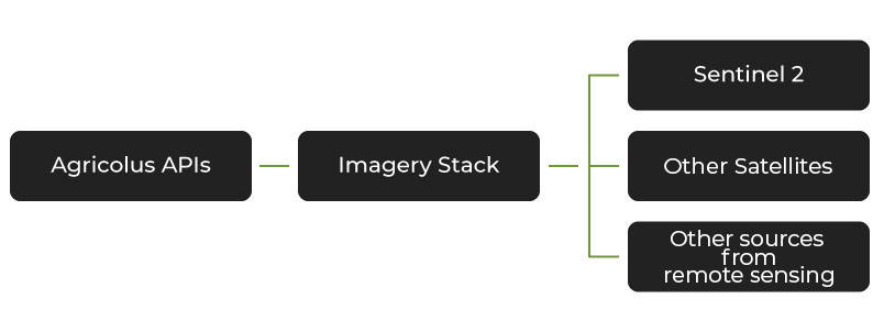
The satellite imagery processing workflow is carried out internally by the Agricolus team. We start with raw satellite data, which undergoes pre-processing to exclude non-agricultural areas, followed by the following steps:
- Calculation: vegetation indices are calculated using specific algorithms.
- Normalisation: the indices can be rescaled between the minimum and maximum values within an area defined by the user to improve visualisation and highlight local variability.
- Resampling: resampling enables a better visualisation of the spatial distribution of the indices.
Vegetation indices make it possible to assess crop health and development through precise and continuous remote monitoring. They can describe plant vigour or identify specific issues such as water stress or chlorophyll content.
Historical index time series also make it possible to analyse changes in crop conditions over time, providing useful information to monitor variations and identify potential differences within fields.
- NDVI (Normalized Difference Vegetation Index)
- GNDVI (Green-NDVI)
- SAVI (Soil-Adjusted Vegetation Index)
- LAI (Leaf Area Index)
- TCARI/OSAVI (Transformed Chlorophyll Absorption Ratio Index/Optimized Soil-Adjusted Vegetation Index)
- NDMI (Normalized Difference Moisture Index)
- NMDI (Normalized Difference Drought Index)
Prescription maps
Prescription maps are a Precision Farming tool that enables variable-rate fertilisation by optimising fertiliser application rates and assigning the most appropriate amount to each area of the field.
Variable-rate fertilisation is based on dividing the field into homogeneous zones, each receiving the same fertiliser application rate.
Agricolus offers an innovative approach to defining these zones: starting from a vegetation index such as NDVI, the algorithm uses a statistical index to determine the maximum number of zones into which it is meaningful to divide the field, as well as the values for each zone.
Through the Imagery API, these processing capabilities can be integrated into other software, expanding the functionalities available for differentiated field management.

Arable land management areas
Starting from historical data for a vegetation index or yield maps, we can develop thematic maps to identify stable and unstable zones within the field and the recurring characteristics of each zone, namely those that are less likely to vary due to temporary stress factors.


Integrate satellite processing into your services
The Imagery API is designed for companies developing farm management software and digital solutions for Precision Farming. It allows them to enrich their services with satellite-derived processing without having to manage the entire image analysis workflow internally.
The Agricolus team provides technical support to help companies integrate the API into their solutions.

